Wikipedia
This text was copied from Wikipedia on 27 July 2024 at 3:10AM.
 | This article needs additional citations for verification. (May 2015) |
Terschelling
Skylge | |
|---|---|
Municipality and island | |
 Flag  Coat of arms | |
 Location in Friesland | |
| Coordinates: 53°24′N 5°19′E / 53.400°N 5.317°E / 53.400; 5.317 | |
| Country | Netherlands |
| Province | Friesland |
| Government | |
| • Body | Municipal council |
| • Mayor | Caroline van de Pol (VVD) |
| Area | |
| • Total | 673.99 km2 (260.23 sq mi) |
| • Land | 85.26 km2 (32.92 sq mi) |
| • Water | 588.73 km2 (227.31 sq mi) |
| Elevation | 6 m (20 ft) |
| Population (January 2021)[4] | |
| • Total | 4,870 |
| • Density | 57/km2 (150/sq mi) |
| Demonym | Terschellinger |
| Time zone | UTC+1 (CET) |
| • Summer (DST) | UTC+2 (CEST) |
| Postcode | 8880–8897 |
| Area code | 0562 |
| Website | www.terschelling.nl |
| Official name | Duinen Terschelling |
| Designated | 29 August 2000 |
| Reference no. | 2215[5] |
.jpg)


Terschelling (Dutch pronunciation: [tɛrˈsxɛlɪŋ] ; West Frisian: Skylge; Terschelling dialect: Schylge) is a municipality and an island in the northern Netherlands, one of the West Frisian Islands. It is situated between the islands of Vlieland and Ameland.
Wadden Islanders are known for their resourcefulness in using anything and everything that washes ashore. With few trees to use for timber, most of the farms and barns are built with masts recovered from shipwrecks. The islands are surrounded by shipwrecks, and even today many containers wash ashore that have blown off the decks of container ships in the North Sea.
The main source of income on Terschelling is tourism. There is some agriculture, but a large part of the island has become a nature reserve.
Terschelling is well known for the yearly Oerol Festival during which theatre performances are played throughout the island, making use of its landscape and nature.
Terschelling can be reached by ferry from the mainland Frisian town Harlingen and in summer from Vlieland by high-speed catamaran.
History
The island in its current shape formed in the Middle Ages from a sandy area called De Schelling in the west and the original island Wexalia in the east. The name Wexalia, Wuxalia, or Wecsile is the medieval name of eastern Terschelling. However, this name disappeared at the end of the Middle Ages. The last appearance of the name Wexalia is in a treaty between Folkerus Reijner Popma, then ruler of Terschelling, with king Edward IV of England in 1482.
The oldest traces of civilization on Terschelling date from around 850, when a small wooden church was built on a hill near Seeryp or Stryp (Striep). This hill was later used as a burial ground and is known as the "Strieperkerkhof".
Historically, tensions existed between the inhabitants of West-Terschelling, with its strong orientation towards the sea, and the more agriculturally oriented inhabitants of East-Terschelling. In 1612 this led to the division of the island into independent political entities, West-Terschelling and East-Terschelling. Only after the French occupation at the start of the 19th century was Terschelling again united as one entity.
The Dutch navigator Willem Barentsz was born on Terschelling around 1550.
In 1666 West-Terschelling was ransacked by the English. The English fleet had originally planned to attack the Dutch merchant fleet which was moored before the coast of Vlieland, the next island to the west. When the Dutch vessels retreated towards Terschelling, the English followed, destroyed 150 Dutch vessels, and landed in the harbour of West Terschelling. The town was burnt to the ground by the English on this occasion which would become known as "Holmes' Bonfire" after the English admiral Sir Robert Holmes. The Great Fire of London in the very same year was considered by some to have been God's retribution. The next year, in 1667, the Dutch under command of De Ruyter executed a retaliatory expedition, and dealt the English navy a heavy blow at the Raid on the Medway (also known as the Battle of Chatham), in effect ending the Second Anglo-Dutch War.
In 1799, HMS Lutine, a British frigate loaded with British gold, sank on the western Terschelling coast (was erroneously quoted in the lemma on Texel) in a storm. Her wreck shifted in the sands; despite several intensive, well-financed searches, only a few treasures have been found. A beaker made from a silver bar is displayed in the National Maritime Museum at Greenwich. Her bell was recovered and is now in the headquarters of Lloyd's of London, where it is tolled before announcing important news.
Until 1942 Terschelling, like Vlieland, was part of the province of North Holland.
Language
On the island of Terschelling both Dutch, the national language of the Netherlands, and Frisian are spoken. Historically, Frisian dialects have dominated on the western and eastern sides of the island while a Dutch dialect called Midslands has been the main language of Midsland and the surrounding area at the center of the island. However, the use of the three dialects is on the decline, and all three are slowly being replaced by the standard Dutch language.
Cranberries
The island is known for being one of only two Wadden islands where cranberries grow, the other being the island of Vlieland. In 1840, a barrel of cranberries, apparently packed by sailors as an antiscorbutic, washed ashore on the island's coast, and the islanders cultivated them for their own sailors.
The cranberries, finding the environment favorable, established themselves on the island. Nowadays, the cranberry fields cover 0.48 km2 (0.185 sq mi) or 48 ha (119 acres). The cranberries are mainly sold to tourists and used by the island's restaurants and bakeries.
Population centres
Areas in Terschelling are the following: (Standard West Frisian names in brackets)
- Baaiduinen (Baaidunen)
- Formerum (Formearum)
- Hee
- Hoorn (Hoarne)
- Kaard
- Kinnum (Kinum)
- Landerum
- Lies
- Midsland (Midslân)
- Midsland aan Zee (Midslân oan See)
- Midsland-Noord (Midslân-Noard)
- Oosterend (Easterein)
- Seerijp (Stryp)
- West aan Zee (West)
- West-Terschelling (seat) (West-Schylge)

Notable people
- Bauck Poppema (died 1501), legendary Dutch heroine
- Willem Barentsz (c. 1550 – 1597), Dutch navigator, cartographer and Arctic explorer; the Barents Sea was named after him.
- Frank I. Kooyman (1880–1963), Dutch hymnwriter
- Hessel van der Kooij (born 1955), Dutch singer
- Joris Voest (born 1995), Dutch professional footballer
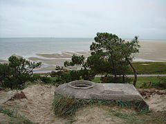
Gallery
-
 the isle of Terschelling
 -
 Shop in Terschelling
 -
 the isle of Terschelling
 -
 Terschelling, Commandeurstraat


See also
- Oan Schylge, the island's anthem
References
- ^ "College van B&W" [Board of mayor and aldermen] (in Dutch). Gemeente Terschelling. Archived from the original on 2 October 2013. Retrieved 29 September 2013.
- ^ "Kerncijfers wijken en buurten 2020" [Key figures for neighbourhoods 2020]. StatLine (in Dutch). CBS. 24 July 2020. Retrieved 19 September 2020.
- ^ "Postcodetool for 8881EB". Actueel Hoogtebestand Nederland (in Dutch). Het Waterschapshuis. Retrieved 29 September 2013.
- ^ "Bevolkingsontwikkeling; regio per maand" [Population growth; regions per month]. CBS Statline (in Dutch). CBS. 1 January 2021. Retrieved 2 January 2022.
- ^ "Duinen Terschelling". Ramsar Sites Information Service. Retrieved 25 April 2018.
2 Annotations
Third Reading
San Diego Sarah • Link
In Dutch, 'Ter' usually indicates a place, like 'at the'. It's a combination of an old preposition (te) and an old article (der). * ter plaatse = at the place * ter wereld = in the world. Terschelling is the general area on the mainland of the Netherlands.
This 21st century map shows the islands that protect the entrance to the port of Amsterdam, which includes Vlieland, Texel and are collectively known as the West Frisian Islands. Tershelling is directly east of them. Move the map south, and you can see how the tiny country of the Netherlands is interconnected.
https://mapcarta.com/West_Frisian…
San Diego Sarah • Link
'The Vlie or Vliestroom is the seaway between the Dutch islands of Vlieland, to its southwest, and Terschelling, to its northeast.
'The Vlie was the estuary of the river IJssel in medieval times.
'In 1666 the English Adm. Robert Holmes burnt a Dutch merchant fleet of 130 ships (Holmes's Bonfire), that had taken refuge in the Vlie, mistakenly supposing the English could never find their way through the treacherous shoals along its coastline.
'Today it's still possible to reach the port of Harlingen by way of the Vlie.
'It is often supposed that the old Roman name for the lake that later would become the Zuiderzee: Lacus Flevo, is etymologically related to the name "Vlie" and that perhaps Vlie was once the name of the entire lake and the big river that flowed out of it.
'In the 13th century large floods widened the estuary and destroyed much of the peat land behind, creating a continuous area of sand and mudflats connecting the sea to the enlarged inland lake and obscuring the flow of the river. When the Afsluitdijk was created, the old streambed from the river to the sea was obstructed.'
https://en.wikipedia.org/wiki/Vli…